Reinebringen Hike: Complete Guide
The short version: 1,974 stone steps, about 448 metres of climbing, roughly two and a half to three hours round trip for a fit hiker, and a view over Reine that anchors half of Lofoten's postcards. Here is what the climb is really like and when to skip it for a guided snowshoe route instead.
Booking choice: Paddle past rorbuer and bridges with a guide and tandem-kayak equipment. Discover 3-hour Reinefjorden paddle
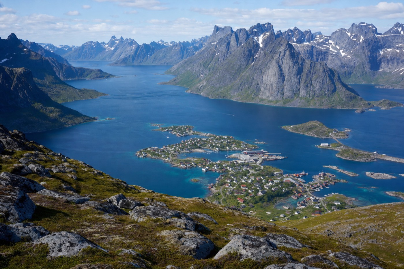
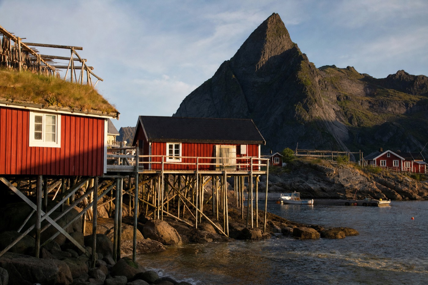
Reinebringen is the mountain that rises directly behind Reine, and its summit ridge produces the single most reproduced view in Lofoten: the village scattered across islets in Reinefjorden, framed by the jagged peaks around it. The hike itself is short by mountain standards but steep enough that "short" is misleading if you turn up unprepared.
The climb, by the numbers
Figures from Visit Lofoten's own trail guide and the Sherpa stair project completed in 2021.
For a guided option: Discover 3-hour Reinefjorden paddle
How many steps is it, really?
1,974 stone steps, built by a Nepalese Sherpa trail crew and finished in late summer 2021, now run all the way from the trailhead near the Djupfjorden bridge to the summit ridge. Before the stairway existed, the route was a rough, often muddy scramble; the finished staircase is a genuine engineering project, similar in style to Sherpa-built trails elsewhere in Norway, and it changed the hike from a scramble into a defined, if relentless, climb.
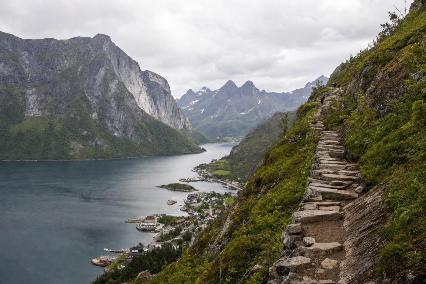
The elevation gain is roughly 448 metres from the trailhead to the main viewpoint, with the true summit sitting a little higher again at around 484 metres. Distance covered is short, around 5 kilometres round trip, which is exactly why people underestimate it: the entire gain happens over a short horizontal distance, so the average grade is steep throughout rather than building gradually.
How long does it actually take?
Budget two and a half to three hours round trip for a reasonably fit hiker moving at a steady pace, more if you are stopping often for photos or hiking with children, and noticeably more in winter conditions when the steps ice over. The climb itself is the slow part; the descent moves faster but is harder on the knees given how steep and continuous the steps are.
| Pace | Up | Down | Total |
|---|---|---|---|
| Fast, minimal stops | ~50-60 min | ~35-45 min | ~1.5-2 hours |
| Steady, some photo stops | ~75-90 min | ~50-60 min | ~2.5-3 hours |
| With children or frequent breaks | ~2 hours | ~75-90 min | ~3.5-4 hours |
Is it dangerous, or just steep?
The staircase itself is well built and secure in good conditions, but Visit Lofoten's own guidance is explicit that the hike is not recommended in winter or in rain, because the stone steps become extremely slippery and the final stretch to the true summit runs along an exposed ridge without a handrail. This is not a warning aimed at inexperienced hikers only. Wet stone on a steep gradient is genuinely hazardous regardless of fitness level, and the upper ridge has real drop-offs on both sides.
This is exactly why the guided alternatives on this site exist for the winter months: rather than the summer stone-step route, they use snowshoes on different, gentler terrain designed for snow conditions, with a guide reading the day's actual footing rather than a fixed staircase that may be sheeted in ice.
What should you bring?
| Item | Why |
|---|---|
| Sturdy, ankle-supporting shoes with real grip | Stone steps are uneven in height and can be wet even on a dry day from spray and shade |
| Water, more than you think | The steep, continuous gradient burns through hydration faster than a gentler trail of the same distance |
| A windproof jacket | Wind picks up sharply on the exposed upper ridge even on a calm day at the trailhead |
| A spare dry layer | You will likely be sweating on the climb and cold within minutes at the summit |
| Trekking poles (optional but common) | Take real pressure off the knees on the descent, which is steeper than it looks in photos |
Where do you park, and does it cost anything?
Two main options: the small, free Steffenakken lot just past the Djupfjorden bridge on the E10, closest to the trailhead but limited to roughly 20 to 30 spaces with a 4-hour limit, or the larger paid Reine outer-harbour lot a short walk further, which rarely fills up. In peak summer the Steffenakken lot fills early in the day, so arriving before mid-morning or being prepared to park at Reine harbour and walk the extra distance is the realistic plan.
| Lot | Cost | Distance to trailhead | Capacity |
|---|---|---|---|
| Steffenakken (P1) | Free, 4-hour limit | Closest, right by the trailhead | Small, ~20-30 spaces, fills fast |
| Reine outer harbour (P2) | Paid, roughly a few hundred kroner an hour range | Short walk further | Much larger, rarely full |
Best time of year, and time of day, to hike it
Late spring through early autumn (roughly May to September) is when the stone staircase is actually dry and safe to climb; outside that window, the guided snowshoe routes on gentler terrain are the sensible substitute rather than attempting the icy stairs. Within the hiking season, early morning or evening light gives the strongest photos at the summit and avoids the midday crowd at the narrow lower switchbacks, where foot traffic can bottleneck in July and August.
During the midnight sun weeks, an evening ascent timed for the golden, low-angle light is a genuinely different experience from a midday climb, since the sun never fully sets and the light stays warm for hours.
What can you actually see from the top?
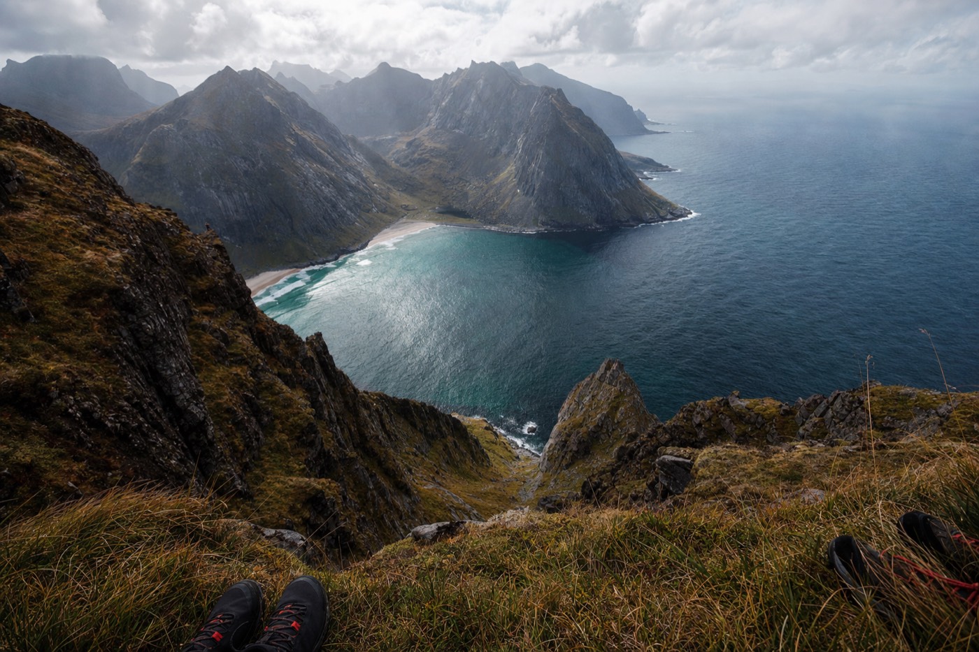
The core reward is Reine itself laid out directly below, plus the neighbouring hamlets of Sakrisøy and Hamnøy and the scattered islets of Reinefjorden, with the jagged Lofoten peaks framing the whole scene. On a genuinely clear day the view extends well beyond the immediate fjord, out toward the open sea to the west.
The winter alternative: guided snowshoe routes
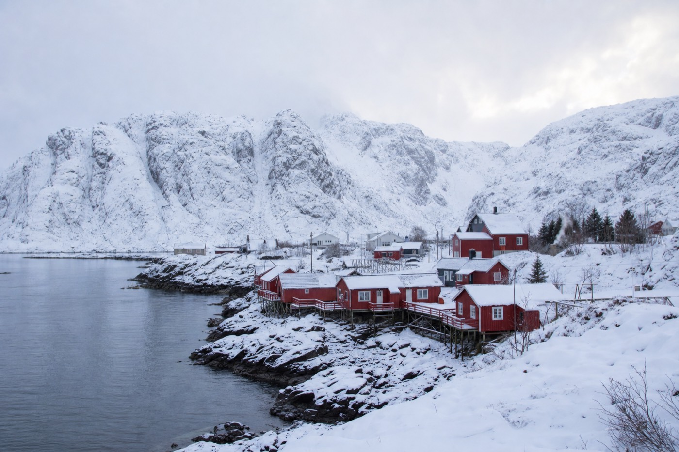
If your trip falls between roughly November and April, skip the Reinebringen stairs and book a guided snowshoe hike instead: the terrain is different, purpose-built for snow, and a local guide reads daily avalanche and ice conditions that a solo hiker on an unfamiliar mountain cannot. The Reine to Ryten route, for example, climbs over 500 metres through changing terrain to a summit panorama that regularly gets described as one of the most emotional views in the archipelago, on ground designed for winter rather than a slippery stone staircase.
For those who want something gentler than a full mountain ascent, the half-day snowshoe tours from Svolvær cover easier ground at a pace suited to complete beginners, no prior snowshoe experience required.
How does Reinebringen compare to Norway's other famous hikes?
Reinebringen is dramatically shorter than Norway's two most famous long hikes, Trolltunga and Preikestolen (Pulpit Rock), but shares Preikestolen's basic shape: a short, steep, well-defined trail to a single dramatic viewpoint rather than a full-day wilderness trek. Where it genuinely differs from both is grade: Reinebringen packs almost all of its climb into a much shorter horizontal distance, which is exactly why the finished stone staircase exists, to make a naturally brutal, eroding scramble into something climbable at all.
| Hike | Round trip distance | Typical time | Character |
|---|---|---|---|
| Reinebringen | ~5 km | 2.5-3 hours | Short, very steep, a defined stone staircase throughout |
| Preikestolen (Pulpit Rock) | ~8 km | 4-5 hours | Moderate grade, a wide, well-trodden trail to a flat clifftop platform |
| Trolltunga | ~20-28 km depending on start point | 10-12 hours | A genuine full-day wilderness trek, far longer and more demanding than either |
What fitness level does the climb actually require?
Moderate cardiovascular fitness is the real requirement, more than any technical hiking skill: the steps themselves are secure and evenly built, but the sustained, unbroken gradient for close to an hour of climbing catches out visitors who assumed "short hike" meant "easy hike."
| Fitness level | What to expect |
|---|---|
| Regularly active, comfortable with stairs and hills | A genuinely achievable, rewarding climb at a steady pace |
| Occasionally active | Doable with more frequent rest stops; budget extra time |
| Sedentary, or with knee or joint concerns | The sustained stair descent in particular is hard on joints; consider the flatter viewpoints lower on the trail instead of the full summit |
| Travelling with young children | Achievable for older, confident children; budget considerably more time and consider stopping at a lower viewpoint rather than the true summit |
Can you combine it with other nearby hikes?
Yes: the Reine to Ryten route and other trails around Moskenesøya sit within a short drive, and several visitors deliberately split a multi-day stay in Reine between the short, sharp Reinebringen climb one day and a longer route like Ryten or a guided winter alternative the next. Doing both on the same day is possible for very fit hikers but is a genuinely long day; most itineraries do better spreading them across two.
What do locals say most visitors get wrong?
Underestimating the descent, not the climb: most first-timers brace for the uphill and are caught off guard by how much harder the steep stone steps are on the knees coming back down, especially on a warm day when the crowds bottleneck at the narrower lower switchbacks. Trekking poles and a genuinely unhurried pace on the way down solve most of this; treating the descent as the easy half of the hike is the single most common miscalculation.
What time of day should you actually climb?
Early morning beats every other window for a first ascent: the trail and car parks are quietest before mid-morning, the light is cleaner for photos, and you avoid climbing during the hottest part of a summer day when the exposed, shadeless staircase gets genuinely warm work. During the midnight sun weeks, a late-evening climb is a real alternative many repeat visitors specifically choose, trading the crowds of the day for warm, low-angle light that lasts for hours rather than minutes.
| Time | Crowds | Light | Trade-off |
|---|---|---|---|
| Early morning | Quietest | Clean, often calmer air | Earliest start required |
| Midday | Busiest, especially July-August | Flattest, least flattering | Warmest climb, most bottlenecking on the stairs |
| Evening (midnight sun season) | Quieter than midday | Long, warm golden light | Only available roughly late May-mid July |
What does the climb actually feel like, stage by stage?
The lower third is the steepest psychologically, since the trail leaves the car park and climbs immediately with little warm-up; the middle section settles into a steady, repetitive rhythm of stone step after stone step through birch scrub; the final stretch breaks above the treeline onto open rock, where the wind picks up and the true summit ridge comes into view. Most hikers describe the middle section as the mental test, since the view does not change dramatically step to step and the top is not yet visible, while the final open stretch is where the payoff starts to become obvious.
Guided or self-guided: does Reinebringen need a guide?
In good summer conditions, no: the trail is a single, obvious staircase with no route-finding required, so most fit, prepared hikers do it entirely unguided. A guide becomes genuinely useful in two situations: winter conditions, where the stairs are unsafe and a guided snowshoe route on different terrain replaces the hike entirely, or for visitors who specifically want local commentary on the history and geology rather than just the physical climb. The guided winter snowshoe options on this site exist for exactly the first case.
Is there a shorter version of the hike for those short on time or fitness?
Yes: the staircase has several natural viewpoints before the true summit, and turning back partway still delivers a real view over Reine, just not the full panorama from the ridge. This is a reasonable compromise for travellers with limited time, mixed-ability groups, or anyone who starts the climb and finds the pace harder than expected; there is no obligation to reach the very top for the visit to be worthwhile. Even a partial climb, turning back a third or halfway up, clears enough of the lower tree cover to open a genuine view over the fjord, which is more than most roadside pull-offs in the area offer.
Whatever pace or distance you settle on, the hike rewards a simple mindset shift: treat it as a steep, short workout with a spectacular payoff rather than a casual stroll, pack for the weather rather than the forecast, and give the descent the same respect as the climb. Visitors who go in with those three expectations set almost universally describe Reinebringen as worth the effort, regardless of exactly how far up the staircase they went.