Kvalvika Beach and Ryten Hike: Complete Guide
The short answer: Ryten is a 543-metre peak above Kvalvika, a beach with no road access at all, and the round trip runs roughly 7 to 12 kilometres depending on which combination of routes you walk, taking 3 to 5 hours. It shares nothing with Reinebringen's stone staircase: this is open moorland, a boggy descent, and a beach nobody drives to.
Booking choice: Climb toward the Kvalvika viewpoint with a local guide, snow equipment and a warm meal. Discover Ryten winter snowshoe hike
Reinebringen gets the fame because it looks down directly on a village. Ryten and Kvalvika are the hike people who have already done Reinebringen ask about next, precisely because it is a genuinely different experience: open terrain instead of stairs, and a payoff that is a wild, empty beach rather than a postcard village.
Kvalvika and Ryten vs Reinebringen
Figures for Kvalvika/Ryten vary by exact trailhead and route combination (Visit Lofoten's own page gives them as approximate); Reinebringen's stair count is precisely documented.
For a guided option: Discover Ryten winter snowshoe hike
What are Kvalvika and Ryten, and how do they relate to each other?
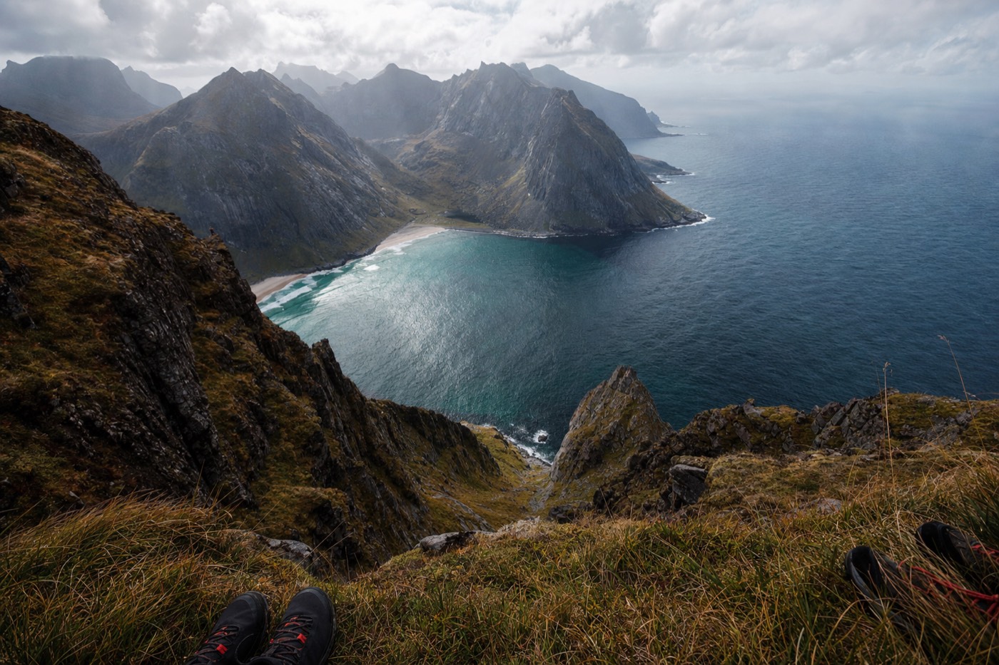
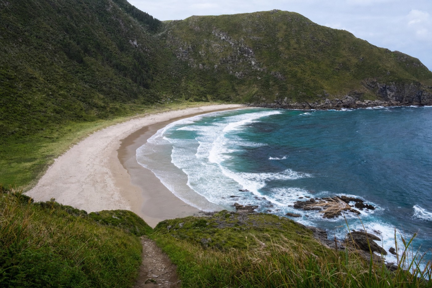
Ryten is a 543-metre peak on Moskenesøya with an open summit ridge looking straight down onto Kvalvika, a horseshoe-shaped beach in a remote cove with no road access at all; most hikers combine the two into a single loop or there-and-back route, since the trails share much of the same terrain. You can walk to Kvalvika without summiting Ryten, or climb Ryten without descending fully to the beach, but the combined route is what most people mean when they say "the Kvalvika and Ryten hike."
This is not the same trail as the winter Reine-to-Ryten snowshoe hike offered as a guided tour on this site. That guided winter version uses different terrain and technique, purpose-built for snow conditions with a local guide reading daily footing; the hike described here is the unguided, ice-free-season route on open ground.
Where does the trail actually start?
The most common starting point is near Fredvang, on the west side of Moskenesøya, with parking at Fredvang school or the Innersand area; from there the trail heads inland and up onto open moorland before splitting toward the Ryten summit ridge or descending directly to Kvalvika. Signage on the ground is minimal in places, which is part of why this trail suits hikers comfortable with open terrain and a map rather than a fixed, obvious path the whole way.
| Trailhead | Best for | Notes |
|---|---|---|
| Fredvang school / Innersand parking | The standard combined Ryten + Kvalvika route | Most commonly used starting point, per Visit Lofoten's own trail page |
| Alternative coastal approaches | Kvalvika-only, avoiding the Ryten summit | Less commonly used; local trail conditions and access can vary by season, check current advice before relying on one |
How far is it, and how long does it actually take?
As rough planning figures, not fixed distances: roughly 3 to 3.5 km one way to the Ryten summit, about 3 km one way to Kvalvika beach, and a combined loop covering both landing somewhere in the 7 to 12 km range depending on the exact route walked; budget 3 to 5 hours round trip for most hikers doing both. The range is wide because different published sources measure from slightly different trailheads and route combinations; treat any single figure as an estimate, not a guarantee, and build in a buffer.
| Route | Approx. one-way distance | Approx. time (one way) |
|---|---|---|
| To Ryten summit only | ~3-3.5 km | ~1.5-2 hours |
| To Kvalvika beach only | ~3 km | ~1.5-2 hours |
| Combined loop (both) | ~6-6.25 km one way equivalent | ~3-5 hours round trip total |
How difficult is it, really, compared to Reinebringen?
Genuinely different, not simply harder or easier: Ryten's own approach is described by Visit Lofoten as more gradual than many of Lofoten's steeper routes, without Reinebringen's relentless staircase, but the trade-off is open, sometimes boggy, unmarked-in-places terrain that demands basic navigation confidence rather than just fitness. A hiker who found Reinebringen's steps physically hard but never got lost may find Kvalvika and Ryten physically easier but navigationally more demanding, and vice versa.
| Kvalvika + Ryten | Reinebringen | |
|---|---|---|
| Surface | Open moorland, boggy sections, no built staircase | 1,974 engineered stone steps |
| Navigation | Some route-finding required, signage is minimal in places | A single obvious path, no route-finding needed |
| Physical demand | Sustained but more gradual climbing | Short, extremely steep, relentless |
| Payoff | A remote, empty beach and a wide summit panorama | A village viewed directly from above |
What does the trail actually look like along the way?
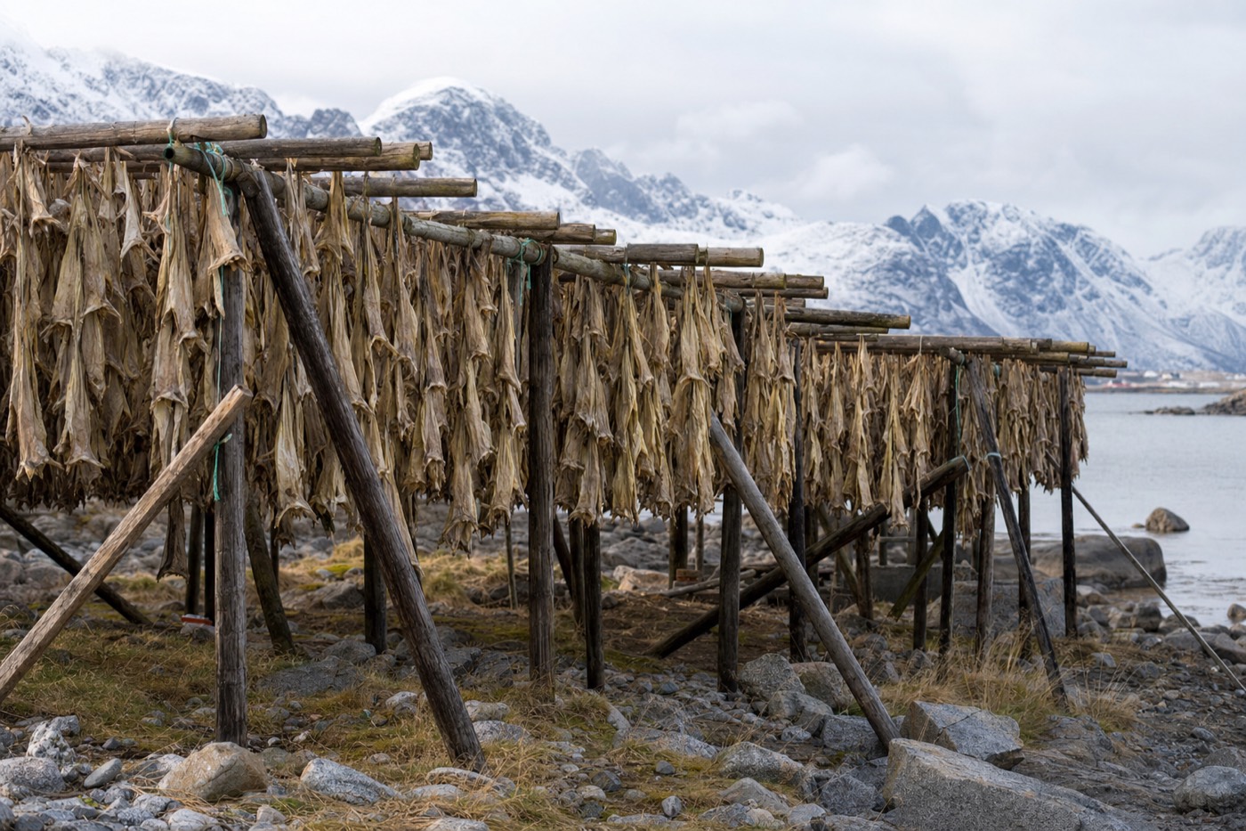
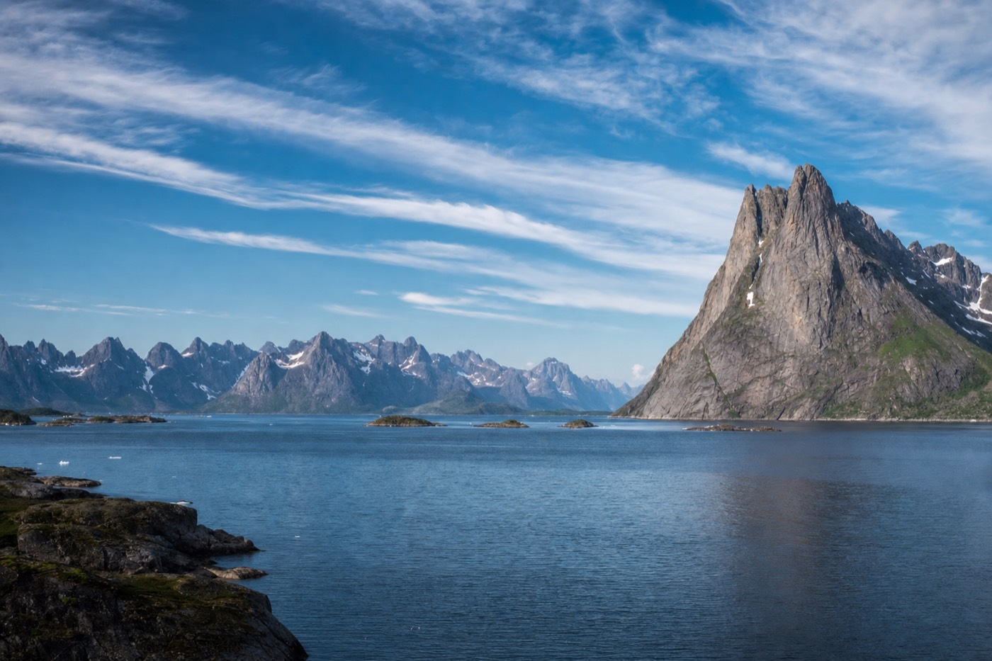
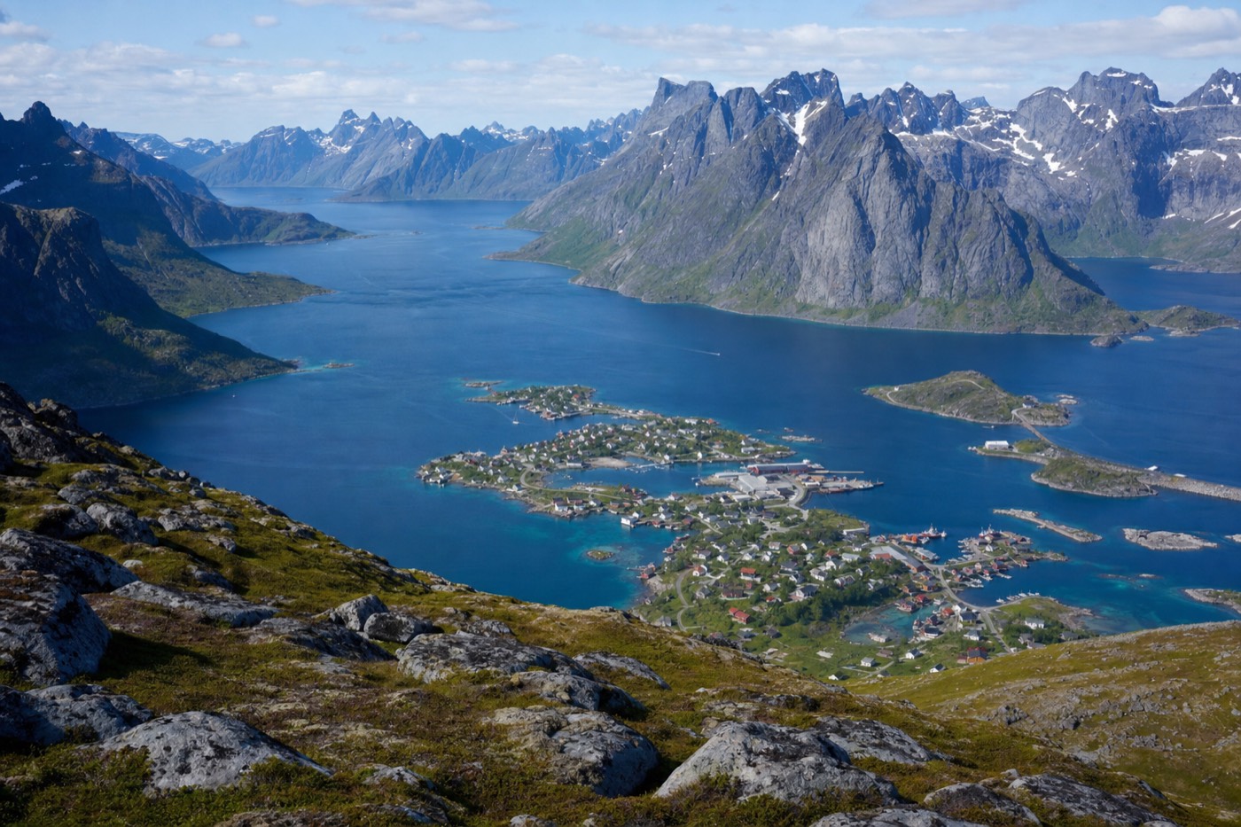
The route climbs from the trailhead onto open, grassy-to-boggy moorland with wide views opening early, unlike Reinebringen's tree-and-switchback lower section; from the Ryten ridge, the ground drops away sharply toward Kvalvika, and the descent to the beach itself crosses genuinely wet, uneven terrain that slows hikers down more than the map distance suggests. Good waterproof boots matter more here than on almost any other Lofoten day hike, precisely because so much of the trail is unpaved, natural ground rather than a maintained surface.
Can you camp at Kvalvika beach?
Wild camping on Kvalvika beach is a genuinely popular option among hikers who want to see the cove without a road anywhere near it, under Norway's general allemannsretten (right to roam) principles, though the sensible baseline rules apply: pack out everything you bring in, camp a reasonable distance from any structures, and never rely on a fire in dry vegetation. The complete absence of road access is exactly what makes an overnight here feel genuinely remote in a way few other Lofoten beaches manage, since Haukland and Uttakleiv both sit a short walk from a car park.
| Consideration | Why it matters |
|---|---|
| No facilities at the beach | Pack in everything, including all water, and pack every bit of it back out |
| No road access | Any gear failure or injury means a real walk back out, not a quick car retrieval |
| Weather can change fast | A calm morning does not guarantee a calm night on an exposed, remote beach |
| Tell someone your plan | Basic safety practice for any remote overnight with no reception guarantee |
What should you actually bring?
| Item | Why |
|---|---|
| Genuinely waterproof boots | Boggy sections are a defining feature of this trail, not an occasional inconvenience |
| A map or downloaded GPS track | Signage is minimal in places; this is not a single obvious path like Reinebringen |
| A windproof, waterproof shell | The open summit ridge and exposed beach both catch wind with nothing to block it |
| More food and water than for a shorter, better-marked hike | The wider time range (3-5 hours) means planning for the longer end |
| A charged phone with offline maps downloaded in advance | Reception is not guaranteed on the open moorland or at the beach |
When is the best time of year to attempt it?
Roughly June through September gives the most reliable dry, walkable ground; outside that window, the same open moorland that makes the summer route manageable becomes genuinely difficult and potentially hazardous once snow and ice cover the unmarked sections, which is exactly why the guided winter snowshoe hike on this site switches to snowshoes and different terrain for winter rather than attempting this same route. Spring thaw is a particular trap: the ground can look walkable while still holding deep, hidden wet patches under a crust of drying vegetation.
What mistakes do hikers make on this route?
| Mistake | Why it happens | Fix |
|---|---|---|
| Underestimating the time needed | Comparing it mentally to Reinebringen's tighter, better-known time window | Budget for the upper end of the 3-5 hour range, especially on a first visit |
| Wearing regular hiking shoes instead of waterproof boots | The bog sections are easy to underestimate from photos | Waterproof, ankle-supporting boots, tested beforehand, not straight out of the box |
| Attempting it in winter without the right gear or a guide | Assuming a summer route stays walkable year-round | Switch to the guided winter snowshoe route instead once snow arrives |
| Not telling anyone the planned route or return time | The trail's remoteness and lighter signage make this more important than on busier routes | Share a plan with someone, especially for a camping overnight |
Why does Kvalvika have no road at all, when nearby beaches do?
Geography, not neglect: Kvalvika sits in a cove enclosed by steep mountains on three sides with the open sea on the fourth, a shape that never offered a practical route for a road the way the gentler ground around Haukland, Uttakleiv or Ramberg did, so the beach was simply left to be reached on foot rather than being an intentionally undeveloped or protected site. That same enclosed geography is exactly what gives the beach its remote, sheltered feel once you arrive, and it is the reason no realistic future road plan changes this; reaching it on foot is not a temporary inconvenience, it is the permanent nature of the place.
Is there a shorter version for hikers with less time or lower fitness?
Yes, in the sense that you do not have to complete the full loop for the effort to be worthwhile: turning back after reaching the open moorland and the first real views, without pushing on to the Ryten summit ridge or descending fully to the beach, still delivers a genuine sense of the landscape and is a reasonable compromise for a mixed-ability group or a tighter schedule. Unlike Reinebringen, where a partial climb still tracks a single obvious staircase, a partial attempt here means being comfortable turning back on open terrain without a fixed endpoint marking "good enough," which suits confident hikers more than complete beginners.
What time of year sees the fewest other hikers on this trail?
Early and late in the walkable season, roughly June and September, see meaningfully fewer hikers than the July-August peak, when both the trail and the small trailhead parking areas near Fredvang get genuinely busy with visitors doing the same well-publicised route. Because Kvalvika and Ryten already demand more self-sufficiency than Reinebringen, a quieter trail is less of a convenience and more of a genuine safety plus, since fewer other hikers around means less opportunity for a quick assist if something goes wrong on the more remote sections.
Is there a guided alternative if you'd rather not navigate it solo?
Yes, though it is specifically a winter product, not a summer guided version of this exact route: the Reine-to-Ryten guided snowshoe hike on this site climbs over 500 metres on snow-adapted terrain with a local expert reading conditions, which is the sensible substitute once the unguided summer trail is no longer safely walkable. Two gentler options, the Lofoten Winter Hike and Snowshoe Experience and the Svolvær Guided Snowshoe Tour, cover easier ground nearby for visitors who want the winter mountain experience without Ryten's fuller ascent.
How does this compare to a day spent at Reinebringen instead?
They reward different things, and a multi-day Reine-area stay comfortably fits both: Reinebringen gives the fastest, most famous payoff for the least route-finding effort, while Kvalvika and Ryten trade a longer, more remote day for a beach that genuinely feels undiscovered and a wider, more open summit panorama. Fit, prepared hikers with two full days in the area do well splitting them rather than trying to combine both into a single exhausting day.
Whichever route or combination you choose, the two hikes share one honest piece of advice: neither rewards rushing. Reinebringen's steps punish a hurried descent, and Kvalvika and Ryten's open terrain punishes cutting the time budget too close on a trail without a fixed, obvious endpoint marking how far is left to go. Give this hike the respect its remoteness deserves and it delivers one of the more genuinely memorable days on the whole archipelago, a beach that still feels undiscovered in a region where that is an increasingly rare thing to say.
For the shorter, staircase-built alternative just up the coast, see the full Reinebringen hike guide. If your trip window falls outside the summer hiking season, the guided winter snowshoe routes on this site are the honest substitute rather than attempting either trail on ice.